
South Holland
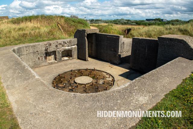
During the Second World War, the historic naval harbour of Hellevoetsluis in South Holland grew into an essential stronghold within the Atlantic Wall, the 5,000-kilometre-long coastal defence system of Nazi Germany.
The German army built a defense line along Europe's beaches from 1942 onwards to discourage an Allied attack: the Atlantikwall. Defending Europe's coasts was a daunting task. From Norway through Denmark, Germany, the Netherlands, Belgium and France, the coastline measured almost five thousand kilometers. The German army, therefore, concentrated on the most likely places for an Allied invasion: Normandy and Calais.
During the Second World War, the historic naval harbour of Hellevoetsluis in South Holland grew into an essential stronghold within the Atlantic Wall, the 5,000-kilometre-long coastal defence system of Nazi Germany.

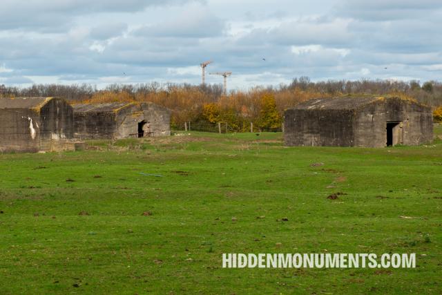
As if the Atlantic Wall defensive strongholds in the Ostend dunes were not enough, Nazi Germany erected a second line of defence in the hinterland.
The dunes of Raversijde, a seaside resort west of East, are home to not one but two German bunker complexes.
Anyone entering Nieuwpoort via Kinderlaan will come across the remains of the World War II German Widerstandsnest Karthauserdünen.

The Atlantic Wall, Nazi Germany's World War II defence line, stretched over 4,000 kilometres from the North Cape to the most south-westerly tip of France, namely Hendaye.

The Western Scheldt, the gateway to the port of Antwerp, played an essential role during World War II.
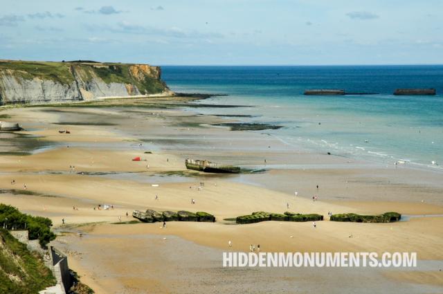
On June 6, 1944, Allied troops landed on the coasts of Normandy. D-Day marked the downfall of the Nazi Empire and the end of World War II.


Just below Wissant, in Audinghen, the heavy guns of Battery Todt had a range of 55 kilometers, just far enough to hit England.

Get the latest stories straight to your inbox
Latest from the blog

On November 9, 1989, the Berlin Wall, a symbol of Cold War division and oppression, was breached. Berliners poured through the newly opened checkpoints.
All photos and stories are copyrighted. Of course, linking to articles on the site is possible and allowed.
If you would like to use photos or articles from this website, please contact bart@hiddenmonuments.com.
© 2003-2025 Hiddenmonuments.com